





✻ Featured ✻
Geelong City Market
 Geelong City Market Geelong City Market is a holistic produce food drink and..
Royal Geelong Show 2026
 Thursday 15th October 2026 - Sunday 18th October 2026 @ Geelong Showgrounds..
Portarlington Makers Market
 The Portarlington Makers Market is a quality artist, artisan and food producers..
Candlelight Concerts in Geelong
 Geelong's best new experience is a concert by candlelight in a unique location..
Geelong School Holiday Guide | Spring
 Geelong's best guide to keep the kids entertained during the School Holidays...
Australian Fashion Superstore
 Discover Australia's leading fashion brands, trusted retailers and online..
Royal Geelong Show 2026
Portarlington Makers Market
Candlelight Concerts in Geelong
Geelong School Holiday Guide | Spring
Australian Fashion Superstore
✻ What's On ✻


✻ Experiences ✻
Comedy
Eat & Drink
Events Calendar
Exhibitions
Experiences
Family Friendly
Markets
Music
Sales
Sightseeing
Sport
Theatre



✻ Featured ✻
Geelong City Market
Geelong City Market Geelong City Market is a holistic produce food drink and..
Royal Geelong Show 2026
Thursday 15th October 2026 - Sunday 18th October 2026 @ Geelong Showgrounds..
Portarlington Makers Market
The Portarlington Makers Market is a quality artist, artisan and food producers..
Candlelight Concerts in Geelong
Geelong's best new experience is a concert by candlelight in a unique location..
Geelong School Holiday Guide | Spring
Geelong's best guide to keep the kids entertained during the School Holidays...
Australian Fashion Superstore
Discover Australia's leading fashion brands, trusted retailers and online..
Royal Geelong Show 2026
Portarlington Makers Market
Candlelight Concerts in Geelong
Geelong School Holiday Guide | Spring
Australian Fashion Superstore
✻ What's On ✻
✻ Experiences ✻
Comedy
Eat & Drink
Events Calendar
Exhibitions
Experiences
Family Friendly
Markets
Music
Sales
Sightseeing
Sport
Theatre
✻ Featured ✻
Geelong City Market
Geelong City Market Geelong City Market is a holistic produce food drink and..
Royal Geelong Show 2026
Thursday 15th October 2026 - Sunday 18th October 2026 @ Geelong Showgrounds..
Portarlington Makers Market
The Portarlington Makers Market is a quality artist, artisan and food producers..
Candlelight Concerts in Geelong
Geelong's best new experience is a concert by candlelight in a unique location..
Geelong School Holiday Guide | Spring
Geelong's best guide to keep the kids entertained during the School Holidays...
Australian Fashion Superstore
Discover Australia's leading fashion brands, trusted retailers and online..
Royal Geelong Show 2026
Portarlington Makers Market
Candlelight Concerts in Geelong
Geelong School Holiday Guide | Spring
Australian Fashion Superstore




✻ Featured ✻
Geelong City Market
Geelong City Market Geelong City Market is a holistic produce food drink and..
Royal Geelong Show 2026
Thursday 15th October 2026 - Sunday 18th October 2026 @ Geelong Showgrounds..
Portarlington Makers Market
The Portarlington Makers Market is a quality artist, artisan and food producers..
Candlelight Concerts in Geelong
Geelong's best new experience is a concert by candlelight in a unique location..
Geelong School Holiday Guide | Spring
Geelong's best guide to keep the kids entertained during the School Holidays...
Australian Fashion Superstore
Discover Australia's leading fashion brands, trusted retailers and online..
Royal Geelong Show 2026
Portarlington Makers Market
Candlelight Concerts in Geelong
Geelong School Holiday Guide | Spring
Australian Fashion Superstore
✻ Latest Announcements ✻
Sailors' Rest New Years Eve Party
 Send off 2026 in style with our massive rooftop + lounge NYE party! Expect..
Powderfinger - Live 2027
 After years of speculation, beloved Australian band Powderfinger have confirmed..
Geelong Contemporary Art Prize 2026
 The 2026 Geelong Contemporary Art Prize continues a long tradition of..
Geelong Beer Festival 2027
 Geelong Beer Festival returns to Johnstone Park on Saturday 6th February..
Sailors' Rest November Set Sails X White Oat Distillery
 We're kicking off November with a Friday night of bold spirits, live tunes, and..
Hans Zimmer Live | The Next Level
 Hans Zimmer is redefining the live concert experience once again. Frontier..
Powderfinger - Live 2027
Geelong Contemporary Art Prize 2026
Geelong Beer Festival 2027
Sailors' Rest November Set Sails X White Oat Distillery
Hans Zimmer Live | The Next Level
✻ Latest Melbourne & Geelong ✻
New Years Eve - H2o | Sunset on the Yarra
 There are New Years Eve parties, and then there's New Years Eve right in front..
Australia's Happiest City Ballarat Becomes Victoria's Regional Cultural Capital This Spring
 Fresh from being named Australia's happiest city in the 2026 Happy City Index,..
VicPol: Stolen Car Search Tool
 VicPol has launched an online stolen car search tool that checks if a vehicle..
Wyndham Christmas Carnival
 The Wyndham Christmas Carnival features over 100 market stalls, live..
Free Electricity Every Day in Victoria: What's the Catch?
 Free electricity sounds simple. Finding out what you actually get takes a bit..
Victorian State Election 2026
 The Victorian State Election will be held on Saturday 28th November 2026. All..
Australia's Happiest City Ballarat Becomes Victoria's Regional Cultural Capital This Spring
VicPol: Stolen Car Search Tool
Wyndham Christmas Carnival
Free Electricity Every Day in Victoria: What's the Catch?
Victorian State Election 2026
✻ Trending ✻
→ Newcomb 3219
→ Tarneit Central Shopping Centre
→ Queenscliff 3225
→ Emergency Telephone Numbers
→ Geelong Showgrounds
→ Bucket List: Top Victorian Nature & Wildlife Experiences
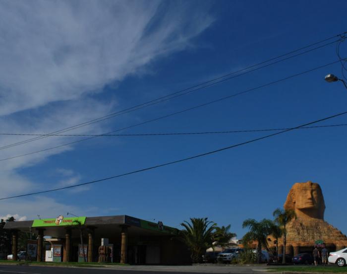
→ Sphinx Hotel
→ Contact OnlyGeelong
→ Bellarine Railway
→ Costa Hall
→ Tarneit Central Shopping Centre
→ Queenscliff 3225
→ Emergency Telephone Numbers
→ Geelong Showgrounds
→ Bucket List: Top Victorian Nature & Wildlife Experiences
→ Sphinx Hotel
→ Contact OnlyGeelong
→ Bellarine Railway
→ Costa Hall